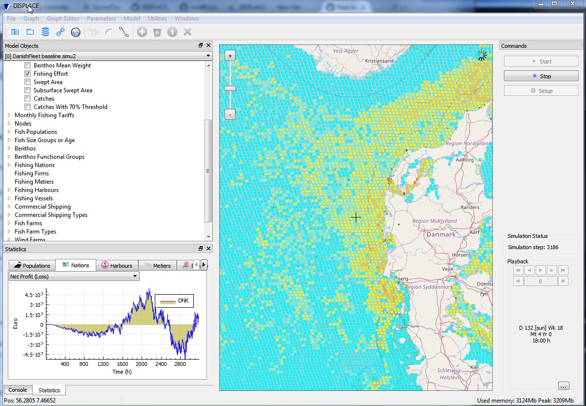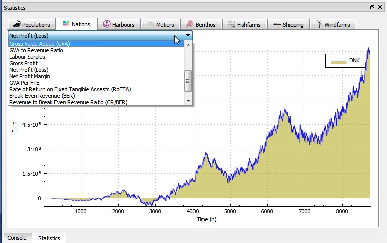
By analyzing fishers´ decision making consequences and predicting likely responses of fisheries to spatial management options, the DISPLACE modelling approach is assessing whether actual fishing opportunities and technical management measures (e.g. regulation of gears, spatial restriction for fishing, etc.) perform well by ensuring sustainable fishing and food provision to the value chain without affecting important fisheries economics. In this context DISPLACE now provides scenario-based assessment and projections of the amount of income generated by national fishing fleets (or other finer fleet segments level economics and fishing harbor communities) over months, quarters and years as long as national input data are available.
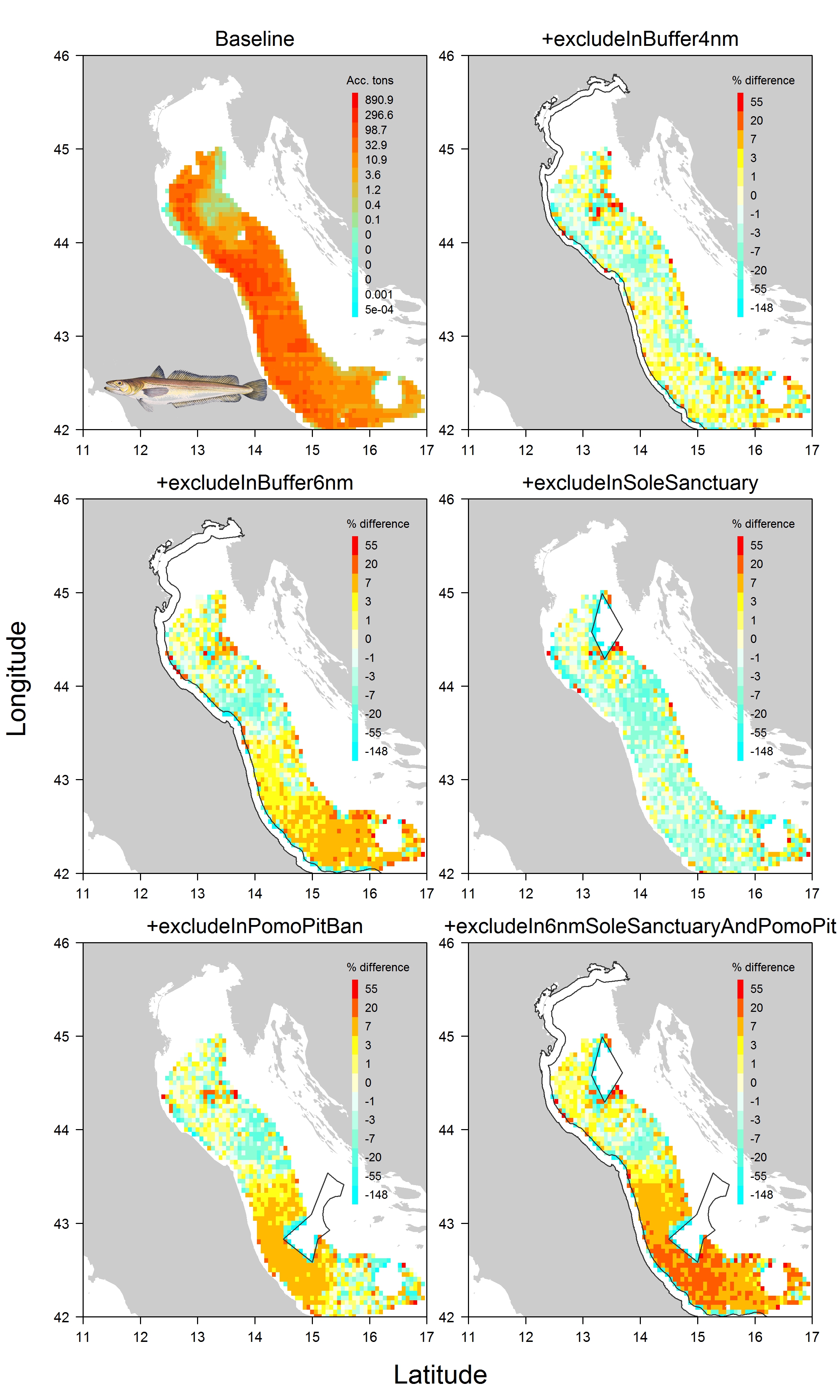
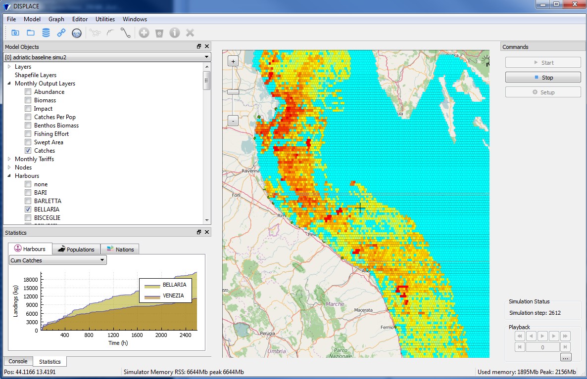
On this issue, important results have been obtained in a row of applications including the Adriatic Sea CS (paper here), the Ionian Sea (in progress), the Black Sea (in progress) and the Baltic Sea CSs, with ongoing data conditioning for the Irish Celtic Sea, some Norwegian Fjords and NE Atlantic Coasts in Portugal.