New fishing technologies designed to protect marine environments show promise, but their success relies on more than just invention. A 2024 study by the European Parliament (https://www.europarl.europa.eu/stoa/en/document/EPRS_STU(2024)762843) examined alternatives to bottom trawling in EU Marine Protected Areas and found a significant barrier: voluntary uptake is extremely low.
The core issue is short-term economic. Most current innovations do not match the catch efficiency of traditional gear. For fishers, switching means potentially lower yields and higher costs without immediate compensation. As a result, many continue using established methods to maintain their income. In some cases, this leads to increased effort to make up for lost catch, which can negate environmental benefits.
If it costs money now, it won’t happen, even if it saves more fish for later.
The report suggests that, because industry adoption has stalled in the absence of financial incentives, the most effective solutions may need to be mandatory rather than optional. It also highlights that policy frameworks must address the socioeconomic reality of fisheries. True sustainability likely requires a balanced approach in which environmental rules are paired with support mechanisms to ensure fishers are not left bearing the full cost of the transition.
However, the debate often misses a crucial long-term perspective: protecting marine habitats is not just an ecological goal, but a safeguard for the fisheries that depend on them. When habitats are degraded, they can no longer sustain the levels of exploitation needed to meet current catches. This fundamentally narrows the supposed trade-off between conservation and fishing; in the long run, one cannot exist without the other. Therefore, sustainable investment and the adoption of innovative technologies cannot succeed unless exploitation is balanced with the fish resources. Without this equilibrium, short-term gains risk leading to long-term collapse.
In the European context, this points to a clear conclusion: technological innovation is necessary, but it must be supported by smart policy that aligns conservation goals with the economic stability of the fishing sector. Without this alignment, good ideas risk remaining unused.
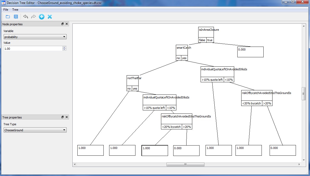
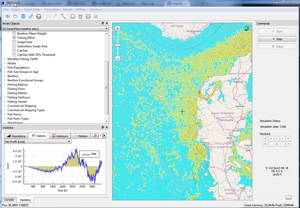
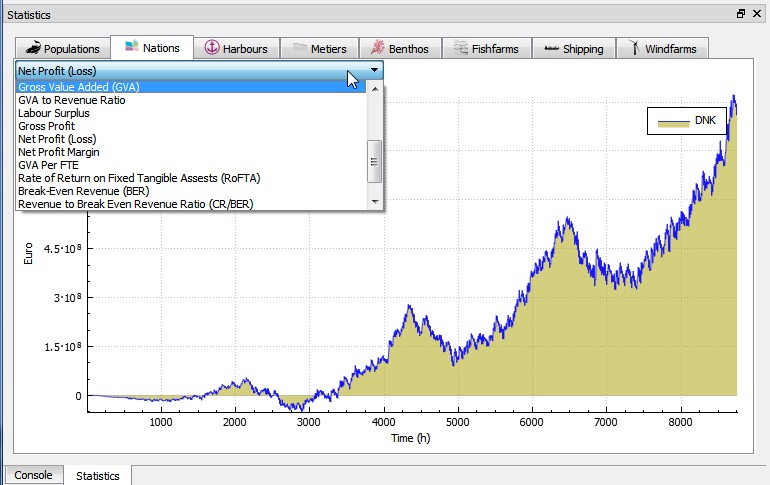
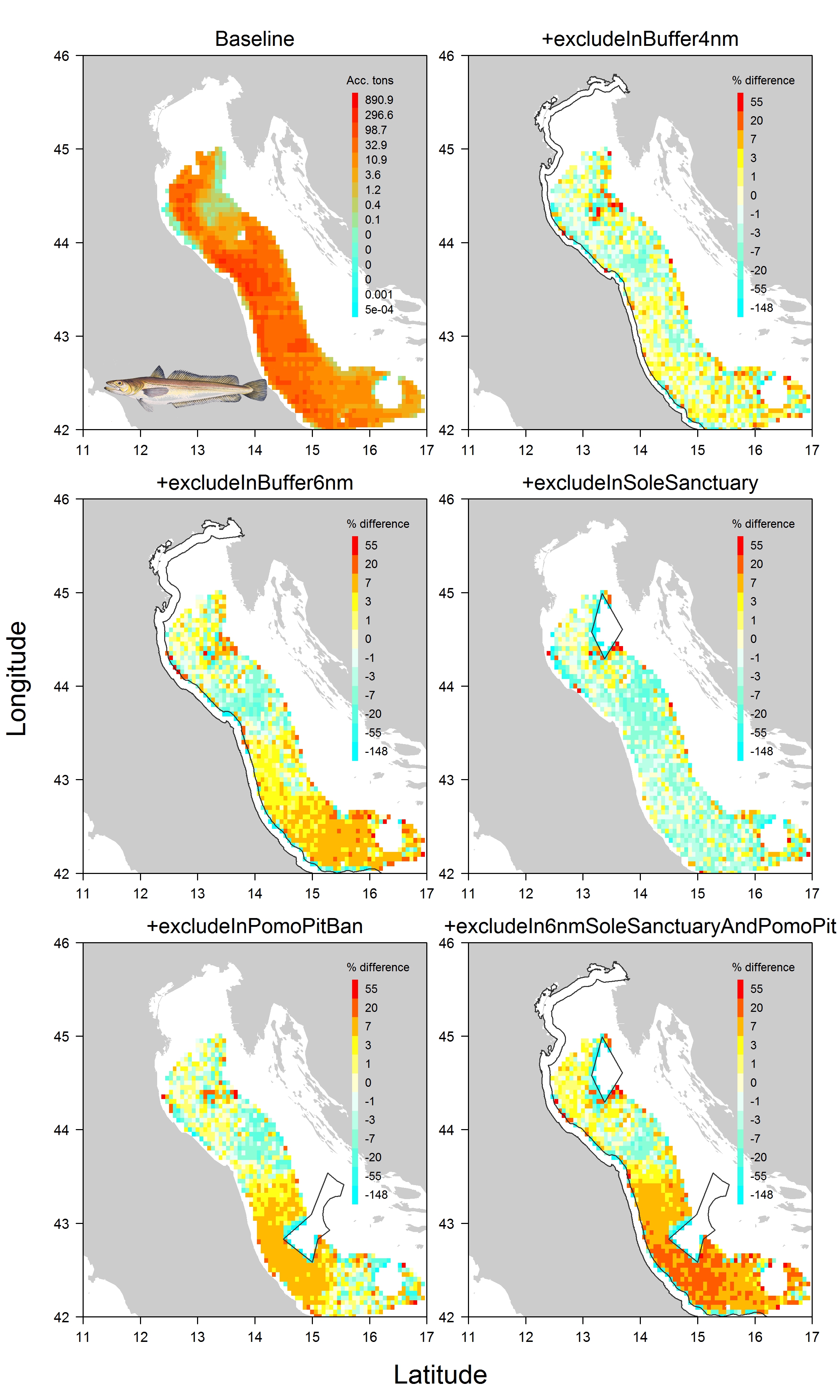
See some slides here.
References:
STOA (2024). Exploring the viability of innovative fishing technologies as an alternative to bottom trawling in European marine protected areas: An environmental and socioeconomic analysis 2024. Author: Bastardie F. for STOA Panel for the Future of Science and Technology (Brussels: The European Parliament).
Bastardie, F., Salvany, L., Cooper, A. M., & Carvalho, N. (2024). A roadmap to reduce the risk of overexploiting EU marine living resources in a changing ocean. Frontiers in Marine Science, 11, 1352500. https://doi.org/10.3389/fmars.2024.1352500